.webp)
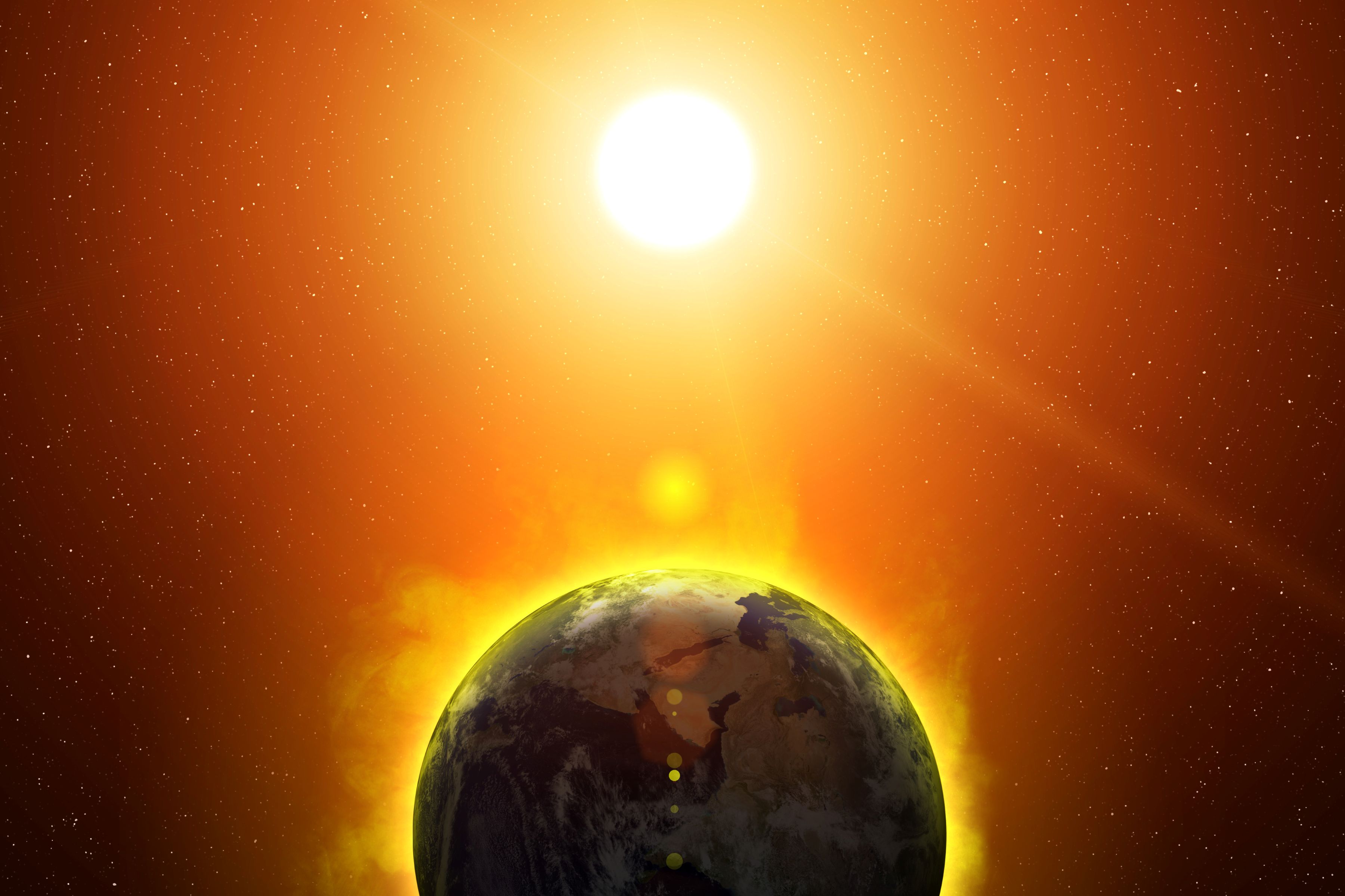
El Niño’s Impacts Are Already Underway
Its impacts are not usually immediate, but in India, the below-average monsoon predicted by the Indian Meteorological Department has thus far come to pass. And in the western Pacific, the already-stricken Northern Mariana Islands and Guam faced their second supertyphoon in 12 weeks, highlighting the tropical cyclone risk for this area.
1. Weaker Indian Monsoon
Weaker Indian monsoon brings drought and crop failure. One of the most immediate impacts of this year’s transition to El Niño is a weakening of the Indian monsoon. Most of India’s worst droughts are associated with El Niño, and a weaker monsoon can bring food insecurity to the Indian subcontinent. The Indian Meteorological Department predicted a weaker monsoon and the risk of significant crop loss, and thus far, their predictions have been accurate. The monsoon started late and moved slowly across the country. June rainfall was 40% lower than average: the fifth-driest June since 1901. Indian farmers have planted less, with the government estimating a 25% reduction in rice planting, and 23% reductions in other crops. Thus far, July rains have been below normal for most of India as well, though heavy rains forecast for the end of July could provide some relief.
2. Tropical cyclone risk increases in the Pacific and decreases in the Atlantic.
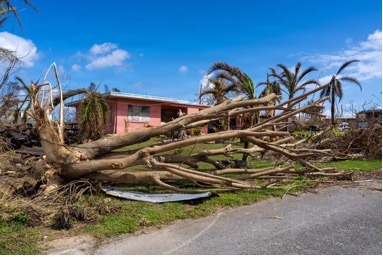
The Pacific has already seen major typhoon activity, but experts predict a less active than normal season for the Atlantic. El Niño’s warm ocean temperatures provide additional fuel to Pacific storms, raising the ceiling on how strong these storms can get. Guam and the Northern Mariana Islands, where typhoon exposure doubles during El Niño years, are seeing the consequences of a warmer Pacific Ocean firsthand. Twelve weeks after Supertyphoon Sinlaku killed 17 people and caused roughly $1.5 billion in damage across Guam and the Northern Mariana Islands, Supertyphoon Bavi exploded into a Category 5 storm, making a second landfall in just 12 weeks in this already hard-hit area. Recovering from one storm can take months in these remote communities; two storms in just 3 months is a massive setback. And while a major storm has yet to impact Hawai’i, western Mexico, or the eastern Pacific Ocean, El Niños can supercharge storms in this part of the world as well. The strongest eastern Pacific storms on record: Linda (1997) and Patricia (2015)--formed during El Niño years. And Otis (2023) exploded from a tropical storm to a Category 5 storm in less than 24 hours. This El Niño-fueled rapid intensification led Otis to be the costliest East Pacific hurricane ever, as well as one of the deadliest, and one of the most poorly forecast storms in recent years.
In the Atlantic Ocean, on the other hand, hurricane activity is typically lower during El Niño years, as El Niño conditions tend to make the background environment in the Atlantic less favorable to hurricanes. This year’s seasonal forecasts for the Atlantic Ocean have repeatedly predicted lower-than-usual hurricane activity, a prediction that has held true thus far. But some scientists fear that increasingly warm temperatures in the Caribbean Sea and Gulf of Mexico could overcome any effects of El Niño in future years. While those in the Caribbean Sea and Eastern and Gulf Coasts of the U.S., Mexico, and Central America will hope for a season free of major hurricane damage, it’s wise to remember the National Hurricane Center’s warning: it only takes one storm where you live to make it a bad season.
El Niño is likely to impact drought, rainfall, food security, and wildfire across the globe.
El Niño is just getting started, but its global impacts in the coming weeks and months could be massive. Below, we list 8 possible ways in which El Niño could impact global weather and climate over the next year. We note that while El Niño increases the probability of these events and hazards, it is not a guarantee that these events will happen. The Earth’s climate is complicated, and no two El Niños have the same impacts. With that in mind, here are 8 hazards to keep an eye on as El Niño unfolds.
3. Drought risk and rising food insecurity for Central America and southern Africa
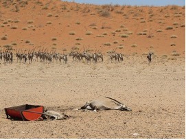
El Niño raises the global risk of drought and famine, especially in Central America and southern Africa. For much of the world, El Niño years mean drought and famine risk: global grain production in the tropics can decrease by as much as 3%, and the 1982 - 1983 El Niño is considered the catalyst for the largest global crop failure in modern history. Rising oil, gas, and fertilizer prices further exacerbate the risk of food insecurity and crop failure this year.
The risk of drought and famine is particularly high for Central America’s Dry Corridor and southern Africa. In Central America, the 2015 - 2016 El Niño brought drought, maize crop failure, and famine risk to an estimated 3.5 million people. Climate change has already worsened drought risk in Central America, and El Niño could make things even worse. Southern Africa also sees widespread drought during El Niño years; in fact, no other agricultural region on Earth is more impacted by El Niño. The two most recent El Niños saw major losses in grain production in southern Africa, putting millions at risk of food insecurity and famine. The World Food Programme has been coordinating support and preparation across Central America and southern Africa in anticipation of El Niño, in hopes that advance warning can keep millions from famine.
4. Wildfires in southeastern Asia, and more deaths from wildfire smoke.
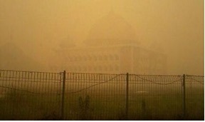
Dry conditions in southeast Asia will increase wildfire risk and could expose millions to toxic wildfire smoke. El Niño is associated with increased drought and wildfire risk over Indonesia, the Philippines, and southeast Asia. Indonesia’s dry season has already been more severe than normal, and Indonesian authorities warned of rising wildfire risk this year. Two of Indonesia’s worst fire seasons occurred during El Niño, and experts fear this year could be another bad fire season. In 2023, wildfire smoke exposed millions in Jakarta to unhealthy air for 7 months, more than half the year. Experts estimate that increased wildfires during El Niño years lead to an additional 10,000 deaths due to wildfire smoke exposure in Indonesia and southeast Asia.
5. Australia faces a hot, dry, and smoky summer
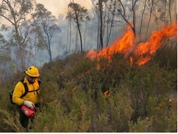
Extreme heat and wildfires in Australia. In Australia, El Niño often brings hot, dry summers with increased bushfire risk. Most of Australia’s largest droughts have occurred during El Niño years, and Australia’s Bureau of Meteorology has predicted below average rainfall for much of Australia during winter and spring. However, despite predictions of a dry month, Australia saw its wettest June in a decade, a reminder that the strength of an El Niño event is not a guarantee of a stronger impact for Australia. Though it’s too soon to know what Australia’s summer will hold, the El Niño event, combined with warmer than average ocean temperatures off of southeastern Australia, could make it a hot, smoky summer down under.
6. Hydroclimate whiplash in East Africa
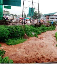
El Niño could fuel heavy rains in East Africa, with especially devastating impacts after a 5-year drought. Eastern Africa is one of the global hot spots for climate whiplash: intense periods of drought alternating with intense, heavy rainfalls. During El Niño, the fall rains, or short rains, can be amplified, bringing heavy rains, flooding, and mudslides to the Horn of Africa and nearby countries. The 2023 short rains displaced nearly 2 million people across the region. In recent weeks, seasonal prediction models have predicted that the western Indian Ocean, off of the coast of Africa, will warm by over half a degree, providing further fuel for the East African rainy season later this year. And while this year’s spring rainy season was wetter than normal, the region has been very dry since 2021. And when heavy rains follow extensive drought, flooding and landslide hazards are even higher.
7. Disease outbreaks after heavy rain in Peru
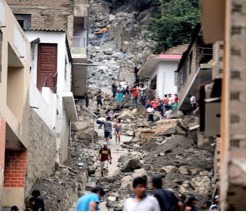
Warm oceans may bring heavy rains and mosquito-borne disease outbreaks to parts of South America. Peru sits on the eastern edge of El Niño. The warm ocean temperatures supercharge storms, bringing heavy rains to the usually-dry coasts of Peru, Ecuador, and Colombia. This year, El Niño’s warm waters have already harmed Peru’s fisheries, which are facing an expected $5 billion shortfall, and farmers worry about the impacts of devastating rains on agriculture. The heavy rains can also cause major disease outbreaks: 60% of Peru’s massive 2023 - 2024 dengue outbreak was attributed to the heavy rains that accompanied that year’s El Niño. In 2026 - 2027, public health officials fear setting a new record for dengue outbreaks.
8. Drought relief, winter rains, and landslide risk across the southern United States
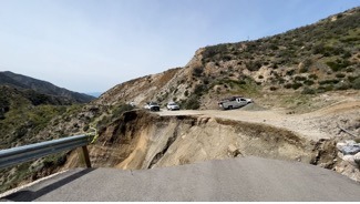
El Niño’s winter rains can be drought-busters for the U.S., but they can also unleash destructive landslides. El Niño often brings wetter winters to California and the southern US. This year, after a record-low snowpack and warm winter in 2025 - 2026, Americans hope that El Niño will bring relief to many areas suffering from drought, and fill up beleaguered rivers like the Colorado. That said, not every El Niño is a drought-buster for North America, despite its amplitude, the 2023 - 2024 El Niño did little to change the drought picture for the U.S. And while the rains can be drought-busters, they also bring a risk of destructive flooding and landslides. This summer’s active wildfire season will raise the threats posed by winter rains. Over 3 million acres have already burned this year, even before the peak wildfire months of August and September. In areas that have experienced recent wildfires, the risk of flooding and landslides along the burn scars is much higher.
9. Heavy rain and flooding east of the Andes
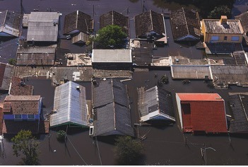
El Niño supercharges storms traveling over the Andes, bringing heavy rainfall and flooding to southeastern South America. El Niño years mean warmer ocean temperatures in the eastern Pacific, off of the coast of South America. These warm oceans mean more moisture in the air. When this warm, moist air travels east over the Andes, heavy rains ensue. Uruguay, Paraguay, southeastern Brazil, and northeastern Argentina are often impacted by extreme rainfall and flooded rivers during El Niño years. El Niño helped flood the Uruguay, Paraguay, and Paraná Rivers in 2015 - 2016, and made southern Brazil’s extreme rains even rainier in 2024. This extreme rain event flooded rivers, displaced hundreds of thousands, caused an estimated 15,000 landslides, and led to outbreaks of waterborne illness. Warming has already made extreme rain events more extreme, further intensifying the possible impacts of El Niño.
Bonus impact: El Niño-fueled powder days in the Andes. El Niño warms the ocean temperatures off of South America’s Pacific coasts, raising the likelihood of intense winter storms for the Andes.
After a slow start to the season, Chilean ski resorts like Valle Nevado and Portillo received as much as 12 feet of snow in a single storm, and the coming days should bring even more snow.
10. Lower severe weather risk in the U.S., but higher severe weather risk in Argentina.
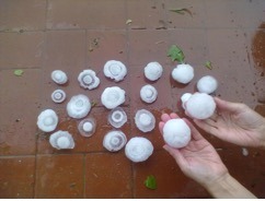
El Niño can raise severe weather risk for Argentina, and lower severe weather risk for the U.S. While El Niño’s role in severe weather outbreaks is more limited, springs following an El Niño often see fewer severe weather outbreaks in the U.S., especially in the traditional tornado hotspots of Texas, Oklahoma, and Arkansas. After an active 2026 severe weather season, a quieter spring in 2027 would be welcome.
Across the Equator, Argentina may face elevated severe weather and hail risk this spring. Recent research suggests that Argentina’s strongest storms are stronger during El Niño, increasing exposure to severe weather and large hailstones in the nation known for the largest hailstones on Earth. Just last week, a large hailstorm hit Buenos Aires, and Argentinian meteorologists attributed the conditions that produced the hail to El Niño.
The Final Boss: A New Global Temperature Record for 2027
During El Niño years, the average temperature across the entire globe is higher than it is during ENSO-Neutral or La Niña years. The 2015 - 2016 El Niño pushed the global mean temperature to 1°C above normal for the first time. We’ve stayed above that 1°C threshold ever since. The most recent temperature record was set in the wake of the 2023 - 2024 El Niño. With an ever-increasing likelihood that ocean temperatures will exceed 2°C above normal by the end of the year, experts are predicting that in 2027, the globe could be as much as 1.7°C hotter than normal. Some fear that we could remain at or above 1.5°C above normal permanently. As the next year unfolds, eyes will remain on El Niño as we unwind its impacts.
This article is part of the Jupiter Research initiative, where our scientists and risk experts explore the climate forces shaping tomorrow's risks. Learn how Jupiter helps organizations quantify uncertainty, evaluate future scenarios, and make more resilient decisions in a changing climate. Contact us here.
